|
Pan American experiences
|
------- |

Colombia |
COLOMBIA ------------------------------------------460[FEATURE] | |||
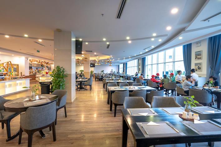
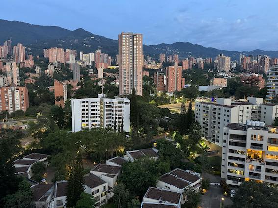
COMUNAS MEDELLINBy Heydi Bernal for Ruta Pantera on 10/16/2025 9:25:34 AM |
||||
| The urban area of Medellín is divided into six reference zones that group 16 communes, with Nororiental Zone 1 being one of them. Although these zones have no formal territorial status, they serve to organize the communes according to their location within the city. The Mayor’s office decided to maintain the division into communes instead of localities and opened the possibility of creating new communes in the future. These communes are subdivided into neighborhoods and institutional areas. Medellín currently has 275 official neighborhoods and 20 institutional areas, which are sectors with neighborhood-like features but without permanent populations, such as university campuses. The rural area is divided into five corregimientos (rural districts), among which San Antonio de Prado and San Cristóbal are the most populated corregimientos in Colombia, each with over 30,000 inhabitants. Medellín’s urban structure follows the course of the Medellín River, which flows from south to north. Commune 1: Popular Popular commune covers an area of approximately 3.1 km² and has about 150,000 inhabitants as of 2025. It borders the municipality of Bello, the corregimiento of Santa Elena, and communes 2 and 3. It includes 12 neighborhoods, many located on steep slopes exceeding 40%, and some areas with inclines over 60%, which complicates construction and puts residents at risk. Several creeks flow through Popular, including La Seca (also called Cañada Negra) and La Herrera, with highly urbanized and mostly informal settlements along their banks, causing frequent flood risks during rainy seasons. The road network is disorganized and fragmented, making mobility difficult. Major thoroughfares include Carrera 39, Carrera 42B, Carrera 46, and Calle 107B. The commune is served by Line K of the Metrocable, which improves access to the higher areas and integrates with the public transport system. Cultural highlights in Popular include Cerro Santo Domingo, the archaeological site Casa de Piedra, Parque Biblioteca España, and the Unidad de Vida Articulada (UVA) La Esperanza, which provides educational and social services. Commune 2: Santa Cruz Santa Cruz is the most densely populated commune in Medellín, covering 2.2 km² with around 120,000 inhabitants in 2025. It borders Bello, communes 1, 4, and 5, and consists of 11 neighborhoods. Its population consolidated in the 1960s with migrants escaping violence and rural poverty. Today, Santa Cruz includes key urban areas such as the minorista market and the administrative center La Alpujarra. With a density of over 520 inhabitants per hectare, Santa Cruz faces significant challenges related to infrastructure and service provision due to its high population concentration. Commune 3: Manrique Manrique has about 150,000 residents spread over 5.5 km², making it the largest commune in the Nororiental zone, with a density of approximately 400 inhabitants per hectare. It borders communes 1, 4, and the corregimiento of Santa Elena. Commune 4: Aranjuez Aranjuez hosts around 140,000 inhabitants in an area of 4.88 km², accounting for nearly 31% of the Nororiental zone. It borders communes 1, 2, 3, and 10, and contains the Ciudad Universitaria, an important institutional sector. Main Challenges in Nororiental Zone 1 Geological risks and territorial vulnerability: Steep slopes and informal settlements along creeks increase exposure to landslides and floods, threatening residents’ safety and quality of life. Infrastructure and service deficits: Gaps remain in access to potable water, sanitation, and electricity, impacting public health and wellbeing. Limited mobility: Fragmented and congested road networks hinder movement, though the Metrocable’s Line K has improved connectivity to high-altitude neighborhoods. Public safety concerns: The presence of criminal groups and urban violence pose ongoing challenges for community security. Unemployment and informal work: High unemployment rates, especially among youth, and the prevalence of informal labor limit economic opportunities. Education and training gaps: School dropout rates and limited access to technical and higher education restrict social mobility. Outlook and Future Projects The Medellín Mayor’s office and partners have launched social urbanism programs aimed at improving public infrastructure, housing, education, and security, while fostering community participation. By 2030, continued investments in mobility, urban equipment, and education are expected to promote greater social inclusion and sustainability in Nororiental Zone 1, helping to overcome long-standing challenges. Let me know if you want me to continue with the next zone or add anything else! Zone 2 – Northwestern Medellín: Robledo, Castilla and Doce de Octubre Robledo: Displacement, Urban Resilience, and Uneven Progress Robledo’s origins trace back to 1880, when the flooding of the La Iguaná stream displaced rural populations, pushing them to settle in the hillsides near El Tablazo. Originally a corregimiento until 1938, Robledo began as a cluster of country houses and a modest urban center. Over time, informal settlements such as San Germán emerged, initiated by descendants of displaced families. These neighborhoods, shaped largely through self-construction and community organization, persist today—many still grappling with limited access to quality public services and social infrastructure. During the mid-20th century, large landowners sought to avoid illegal occupations by selling off steep, hard-to-develop land to low-income buyers. While this provided housing opportunities, it created a legacy of urban inequality, where peripheral areas continue to face inadequate sewage, road maintenance, and education coverage. According to data from Medellín Cómo Vamos (2023), over 47% of households in Robledo report feeling unsafe at night, primarily due to gang disputes and territorial tensions, especially in neighborhoods like Aures and Villa Sofía. Despite these challenges, Robledo is also home to major universities and hospitals, serving as a paradoxical space of both disadvantage and opportunity. Castilla: Industrial Heritage and Ongoing Recovery Comuna 5 – Castilla was urbanized from the 1930s to the 1960s, becoming a key industrial sector for Medellín. Companies like Colanta, Parmalat, Zenú, and Coca-Cola shaped its economic base. Despite this, parts of Castilla fell victim to intense violence during the 1980s and 1990s, with youth recruitment by armed groups and forced displacement affecting entire neighborhoods. Today, Castilla has experienced significant recovery. The homicide rate dropped from 76 per 100,000 in 2010 to 18 per 100,000 in 2023, yet residents in higher zones still report concerns about drug trafficking, lack of job opportunities for youth, and educational gaps. Middle and working-class families dominate the area, and self-owned small businesses—such as workshops, corner stores, and restaurants—are common. Access to public services is robust (above 95% coverage), and recreational spaces like the Juanes de la Paz Park and the José René Higuita Sports Complex bring community life to the forefront. Notably, Castilla is home to Latin America's only regulation-size rugby field, attracting international competitions and fostering local pride. Doce de Octubre: Urban Density and Social Challenges The early settlement of Comuna 6 – Doce de Octubre began in the 1930s in the El Picacho area, with more extensive urbanization taking place from the 1950s onward. The commune has since evolved into a densely populated zone with high rates of poverty and social vulnerability. According to the Departamento Administrativo de Planeación (DAP), more than 36% of households in Doce de Octubre are classified as low-income and face challenges in housing quality, school dropout rates, and domestic violence. The area also struggles with public space deficits and a shortage of cultural facilities, although community-led initiatives have sought to fill these gaps through grassroots organizations and urban gardens. Despite its challenges, Doce de Octubre is rich in neighborhood solidarity and is well-connected via the Medellín Metrocable (Line J), which links it to the city’s transit system and economic core. Comuna 8 Robledo Today: Education and Ecology Amid Inequality Robledo has emerged as a major academic center, hosting institutions such as the Technological Institute of Antioquia, the National University’s Faculty of Mines, Santo Tomás University, the University of Antioquia’s Robledo campus, ESUMER, and the Medical Faculty of Pontifical Bolivarian University. This dense concentration of educational centers offers a stark contrast to the persistent underdevelopment in some of the commune’s peripheral zones. The area’s ecological crown jewel is Cerro El Volador, the largest eco-park in Medellín and a natural reserve of great archaeological significance. It is a vital urban lung and popular destination for hiking and environmental education. Still, inequalities remain sharp. According to the Urban Quality of Life Index (2023), Comuna 7 – Robledo ranks below the city average in indicators like income, housing quality, and access to formal employment, particularly in sectors like Olaya Herrera and El Diamante. | ||||
| Zone 3 – Central Eastern Zone The Central Eastern Zone of Medellín, officially known as Zone 3, includes Comuna 8 (Villa Hermosa), Comuna 9 (Buenos Aires), and Comuna 10 (La Candelaria). Historically, this area has played a central role in the city’s eastward expansion, following the natural paths carved by early settlers along old trade routes. From its origins as a hub of rural trails and hillside farms to its current status as a densely populated urban sector, this zone exemplifies the complex layering of tradition, community growth, and structural challenges. Comuna 8 – Villa Hermosa Villa Hermosa is located on the steep slopes to the east of the city center and spans an area of approximately 577.7 hectares. The population density is high, averaging around 180 residents per hectare. According to Medellín’s 2005 Statistical Yearbook, the comuna had over 104,000 residents, with 67.2% under the age of 39. The socio-economic distribution is predominantly low-income: around 38.5% of homes fall under stratum 2 and 30.3% under stratum 1. This comuna is characterized by its challenging topography and frequent landslide risks. The Santa Elena creek crosses it from east to west, adding to the environmental vulnerability of many hillside neighborhoods. In May 2025, a devastating landslide occurred in the Villatina neighborhood, triggered by several days of intense rainfall. The collapse of a portion of the hillside led to at least six confirmed deaths, dozens of injuries, and the destruction of over 25 homes. Emergency response teams and municipal agencies were deployed to assist the victims, and discussions around urban resilience, informal settlements, and relocation strategies have intensified since the tragedy. The area is also known for its spiritual and social infrastructure, particularly the churches of San Miguel and La Sagrada Familia, which are central to the community identity. Comuna 9 – Buenos Aires Buenos Aires is one of Medellín’s most traditional and emblematic neighborhoods. Centered around 49th Street (Ayacucho Avenue), the comuna features a rich architectural heritage including the gothic-style churches of El Sagrado Corazón and La Milagrosa. Historically, this area served as the primary exit route toward Rionegro and Eastern Antioquia, making it a strategic corridor for trade and migration until the mid-20th century. Today, Buenos Aires is a working-class residential area with a strong sense of local identity. It has undergone significant improvements through the introduction of the Ayacucho tram line, which has enhanced connectivity and mobility. Areas like Miraflores still retain large historic mansions that speak to the neighborhood’s prosperous past, while sectors such as Loreto La Esmeralda continue to grow, now populated by third- and fourth-generation residents. Despite urban revitalization efforts, challenges remain in addressing informal housing, limited public services, and urban congestion, especially in the upper hillside neighborhoods. Comuna 10 – La Candelaria La Candelaria is Medellín’s historical and administrative heart. As the city's downtown core, it houses some of the most iconic buildings, public institutions, and heritage sites in the region. It includes neighborhoods like Prado, Boston, San Benito, and San Diego, each with a distinct character and urban fabric. Architectural treasures such as the Metropolitan Cathedral, La Veracruz Church, and La Candelaria Church — from which the comuna takes its name — are located here. Prado, once home to Medellín's elite, still displays grand early 20th-century mansions that reflect a wide array of architectural styles. While La Candelaria remains a commercial and cultural hub, it also faces significant socio-economic and security challenges. Issues such as homelessness, drug use, public safety, and the deterioration of historic properties are part of the complex urban reality of this densely populated center. Moreover, the transient population and informal commerce often strain public services and infrastructure. | ||||
|
|
||||
|---|---|---|---|---|
| |
|
|
|
|
×
|
||||
Please leave a comment about this article: 460 |
|
| Enter your email address: |
Your email will not be displayed. |
| Your nickname: | |
| Your comment: | |
| Was this article helpful to you? | |
|
|
|
Articles about exciting travel experiences in our hemisphere.


BEACH & SUN

Welcome to the World’s Largest New Year’s Celebration
For those traveling from North, Central, or South America, New Year's Eve in Rio offers a rich narrative about how a city can transform a universal holiday into a unique celebration, rooted in local traditions and open to the world.


|
Experiences Finder
(Search our catalog of articles here.) |
|---|